
For a few months each year, roads that are open the rest of the calendar buried. Snowplow crews in Montana work into late June to clear the last drifts off a single mountain pass, and when the gates finally lift, a stretch of pavement that was impassable in May becomes one of the finest drives on the continent.
Summer is the season when the country unlocks its high country. The road trip is how Americans have always seen it.
What follows is not a ranking. Each of these drives asks something different of you: an early start to beat the crowds at a Utah overlook, a steady hand on a Colorado shelf road with no guardrail, a full tank before a long desert stretch. They reward the effort in their own way.
Going-to-the-Sun Road, Montana
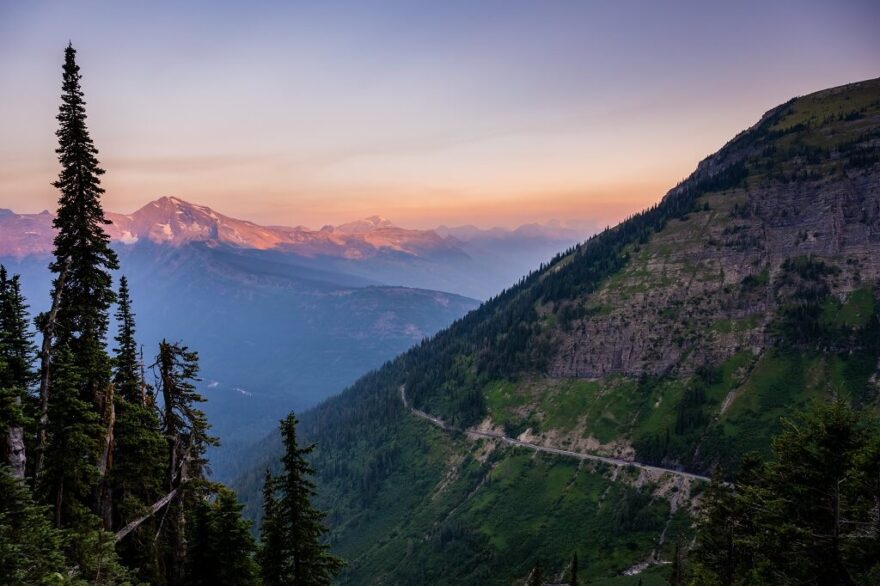
Fifty miles cross Glacier National Park from the prairie edge at St. Mary to the cedar forests near Lake McDonald, and the engineering alone is worth the trip. Crews in the early 1930s blasted the road into the side of the Garden Wall, a near-vertical cliff, and the cuts they made still hold.
The high point is Logan Pass, 6,646 feet, where the road tops the Continental Divide and the parking lot fills before nine in the morning.
The drive earns its reputation in the stops between the entrances. On the east side, the pullout at Wild Goose Island gives you the postcard: a speck of an island in St. Mary Lake with peaks stacked behind it.
Climbing west, the Jackson Glacier Overlook is the one place you can see a glacier from your car, though it has shrunk to a fraction of what early visitors saw and may be gone within a few decades.
Higher still, the road bends through the Weeping Wall, where snowmelt pours straight onto the pavement in early summer, and then doubles back on itself at the Loop, the only major switchback on the western climb.
Stop at the top. Mountain goats pick their way across the rock at Logan Pass, often close enough to photograph without a long lens, and bighorn sheep graze the slopes above the visitor center.
By mid-July, the meadows below the pass turn over to glacier lilies and beargrass, the tall white stalks that bloom in waves some years and barely at all in others. The full road usually opens in late June and closes with the first heavy snow in October, which is the whole reason it belongs on a summer list.
Beartooth Highway, Wyoming and Montana
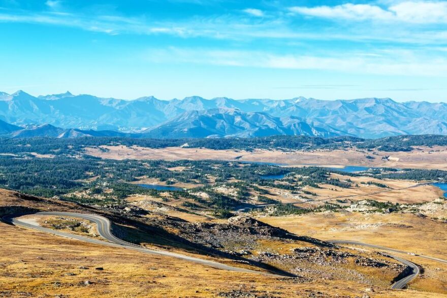
The broadcaster Charles Kuralt, who spent decades crossing the country for CBS, called this the most beautiful drive in America. He had a strong case. U.S. 212 climbs out of Red Lodge, Montana, in a series of switchbacks that gain thousands of feet in a few miles.
Pull off at the Rock Creek Vista point partway up, where a short paved path leads to a railing above a glacier-carved valley that drops away for thousands of feet. Past it, the road tops out on a broad plateau near 11,000 feet, runs by Beartooth Lake and the lonely Top of the World Store, then descends toward the northeast entrance of Yellowstone at Cooke City.
Up top, the world above treeline opens out: tundra, snowfields that linger into August, and small lakes still partly frozen in early summer. Marmots whistle from the rocks, and the air thins enough that you feel the altitude when you step out of the car.
The road sits high and exposed, so afternoon thunderstorms build fast and the plateau is best crossed in the morning. The season is short, generally late May through mid-October, and a single storm can close it in any month.
Highway 1 Through Big Sur, California
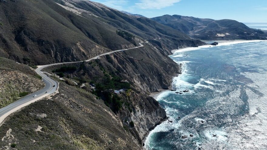
The ninety miles of coast between Carmel and San Simeon hold the stretch of Highway 1 that put the road on every map. The cliffs fall straight to the Pacific, fog moves in and out along the headlands, and the Bixby Creek Bridge, finished in 1932, spans a gorge with the open ocean behind it.
It is the most photographed structure on the route, and the small dirt pullouts at either end fill early on clear mornings.
Two stops are worth building the day around. At Julia Pfeiffer Burns State Park, a short trail leads to an overlook of McWay Falls, an eighty-foot ribbon of water that drops onto a cove beach you cannot reach on foot.
A few miles north, in the cool canyon at Pfeiffer Big Sur State Park, coast redwoods grow at the southern edge of their range, the easiest place on the drive to stand among trees that predate the road by a thousand years. If you have time, the narrow Sycamore Canyon Road drops to Pfeiffer Beach, where flecks of manganese garnet tint the sand a faint purple.
Watch the sky for California condors. The birds were nearly extinct decades ago, and a long reintroduction effort has put them back over Big Sur, where they ride the updrafts on wings that stretch nearly ten feet.
The catch with this drive is that the same geology that makes it beautiful also makes it fragile. Landslides close sections without much warning, sometimes for a season or more, so check the road status before you commit to the full route.
Scenic Byway 12, Utah
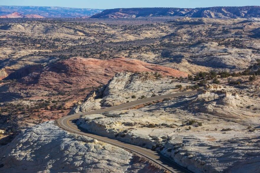
This 122-mile road links Bryce Canyon to the country near Capitol Reef, and it changes character every twenty minutes. It starts in the pink hoodoos around Bryce, drops into the slickrock of Grand Staircase–Escalante, and climbs to ponderosa and aspen on Boulder Mountain, where the elevation tops 9,000 feet and the temperature drops noticeably.
A few miles east of the town of Escalante, the Head of the Rocks Overlook lays the whole geology out in front of you, the road threading off across acres of bare sandstone toward the horizon. Farther on comes the Hogback, a narrow ridge near the town of Boulder with the land falling away on both sides at once and no shoulder to speak of.
Between them, the trailhead for Lower Calf Creek Falls makes a good place to stretch your legs, a level walk along the creek to a 126-foot waterfall in a sandstone amphitheater. Carry water, because service is scarce out here, and the towns are small and far apart.
Red Rock Scenic Byway, Arizona
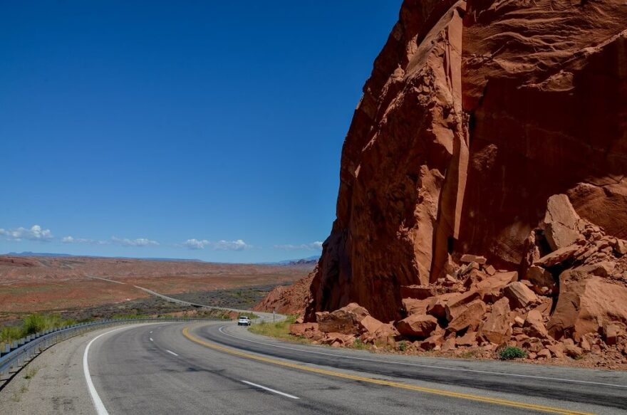
State Route 179 runs only about seven and a half miles, from the interstate up into Sedona, and it earned the federal designation of All-American Road for what it packs into that distance.
The route threads past Bell Rock and Courthouse Butte, with Cathedral Rock rising to the west, all of it the deep rust color that comes from iron oxide staining the sandstone over millions of years.
Light is the thing here. The formations look one way under the flat glare of midday and another entirely in the half hour after sunrise or before sunset, when the low sun turns the rock to ember and throws long shadows across the desert.
The Chapel of the Holy Cross, built directly into a spur of red rock just off the byway, gives you a place to stand and take it in. Come early in summer; by late morning, the heat settles in and the pullouts fill.
The byway also runs through the heart of Sedona’s energy vortexes, the sites many visitors come specifically to feel, with Bell Rock and Cathedral Rock counted among the strongest.
Whatever you make of that, the practical point is that you do not have to admire this drive through a windshield. Park at the Bell Rock trailhead and walk a few hundred yards onto the slickrock, and the scale of the place lands in a way it never does from the road.
The San Juan Skyway and Million Dollar Highway, Colorado
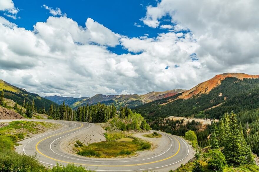
The full San Juan Skyway loops 236 miles through southwestern Colorado, but its most talked-about leg is the 25 miles of U.S. 550 between Ouray and Silverton, the Million Dollar Highway.
The road climbs over Red Mountain Pass at more than 11,000 feet on a shelf cut into the mountainside, often with a sheer drop on one side and no guardrail. The name has several origin stories, including a passenger who reportedly said she wouldn’t drive it again for a million dollars.
Just south of Ouray, the road crosses a bridge over Bear Creek Falls, where the original toll booth once stood, and farther on, the Molas Pass pullout opens onto a basin of peaks above 13,000 feet. This is old mining country, and you pass the rusting headframes and tailings of the boom that built towns like Silverton and Telluride.
Ouray itself sits in a bowl of cliffs that earned it the nickname Switzerland of America. Time a July trip right and the high basins fill with columbine and Indian paintbrush. Drive it in daylight and in dry weather.
Blue Ridge Parkway, North Carolina and Virginia
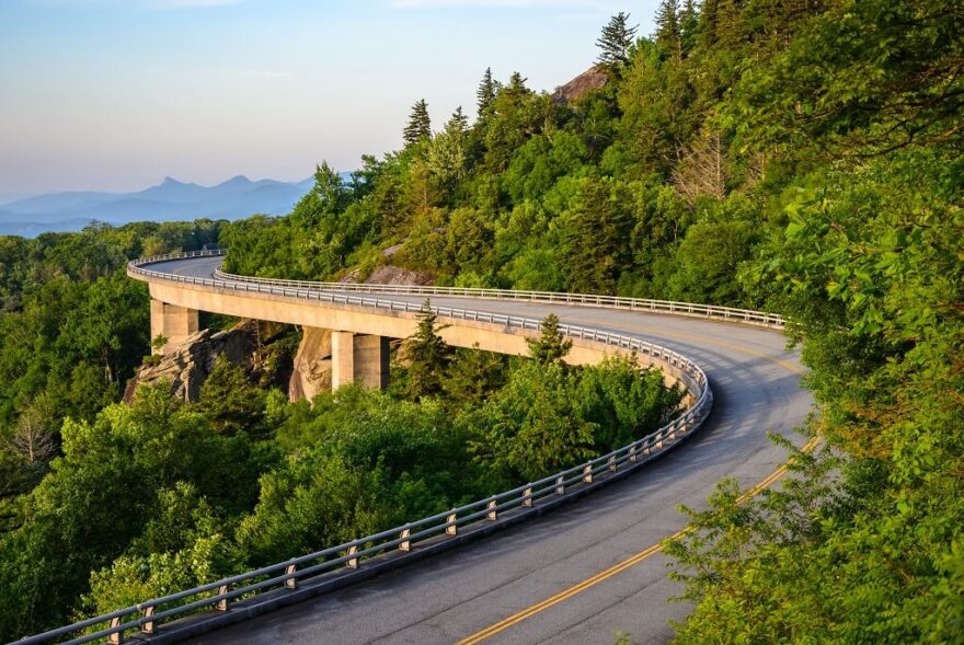
The longest drive on this list runs 469 miles along the spine of the southern Appalachians, connecting Shenandoah National Park to the Great Smoky Mountains. There are no trucks, no billboards, and no stoplights for the length of it, by design; the federal government built the parkway during the Depression as a slow road through the mountains, capped at 45 miles per hour, and it has stayed that way.
The blue that gives these mountains their name is real and explainable. The forest releases isoprene, a compound that scatters light toward the blue end of the spectrum, so the ridges fade into haze as they recede.
In June, rhododendron and flame azalea bloom along the higher overlooks, and the display at Craggy Gardens north of Asheville draws people who plan their year around it.
You do not drive the whole 469 miles in a day, so it helps to know the stops worth slowing for. Mabry Mill, a restored water-powered gristmill in Virginia, is the most photographed spot on the route and sits right beside the road.
Near Grandfather Mountain, the Linn Cove Viaduct curves out from the slope on concrete piers, built that way to avoid scarring the rock face beneath it. A spur road climbs to the summit of Mount Mitchell, at 6,684 feet the highest peak east of the Mississippi, where the temperature can run twenty degrees below the valleys you just left.
The Overseas Highway, Florida
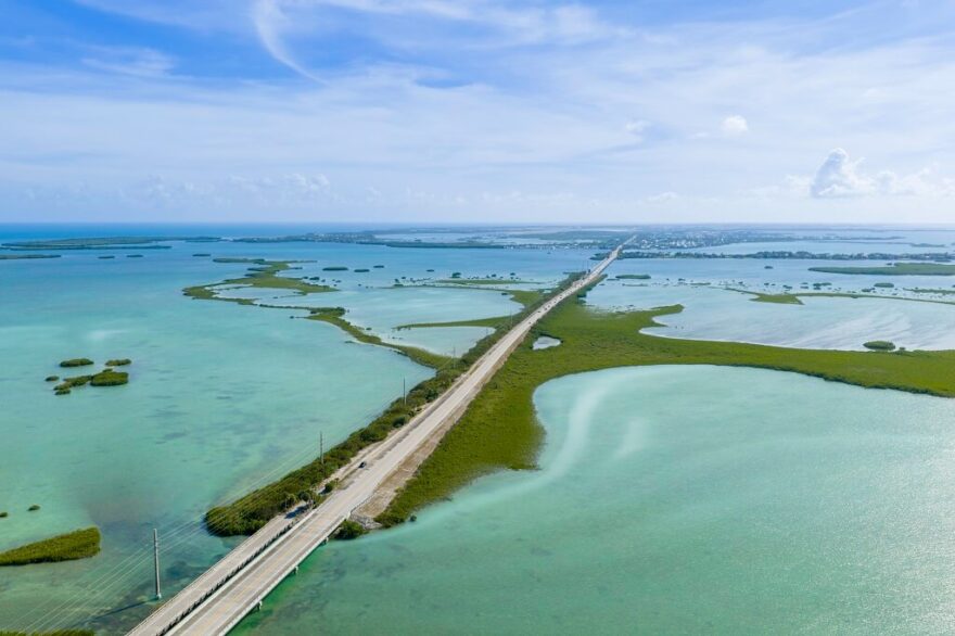
U.S. 1 leaves the Florida mainland and runs 113 miles to Key West across 42 bridges, with water on both sides for much of the way: the Atlantic to the south, the Gulf and Florida Bay to the north, the shallows turning every shade of green and blue. The Seven Mile Bridge is the famous span, a long low line of concrete that, for a few minutes, leaves no land in sight on either side.
The road has a history under it. Henry Flagler completed a railroad to Key West in 1912, an undertaking many thought impossible, and the 1935 Labor Day hurricane destroyed it.
Engineers laid the highway over what remained, and the old railway still runs parallel to the modern bridges in places; the original Seven Mile span crosses Pigeon Key, a former work camp you can still walk or bike out to.
Plan to stop rather than just cross. Bahia Honda State Park, in the Lower Keys, has the best beach on the chain and a view of the old arched rail bridge curving away over the water. Islamorada, halfway down, is built around sportfishing and the shallow flats.
Summer here is hot and humid and falls inside hurricane season, so watch the forecast, but the early mornings on the water are quiet before the day-trip traffic builds out of Miami.
Before You Go
The high mountain roads have short seasons and longer memories of winter, so confirm that the passes are open before you point the car at them. Start early on nearly all of these. Crowds thin in the first hours after sunrise, the light is better for the rock and the water, and you stay ahead of the afternoon storms that build over the high country in July and August.
Keep the tank full where towns are far apart, let someone know your route through the long empty stretches, and pack the road-trip essentials you will not be able to buy once the towns thin out.
The drives themselves are the destination. Leave time to pull over. And if these leave you wanting more pavement, the same instinct runs through quieter routes worth a detour, from the Ross Maxwell Scenic Drive in Big Bend to the Pierce Stocking Scenic Drive above Lake Michigan, with most of the best of them threading through the country’s national parks.